
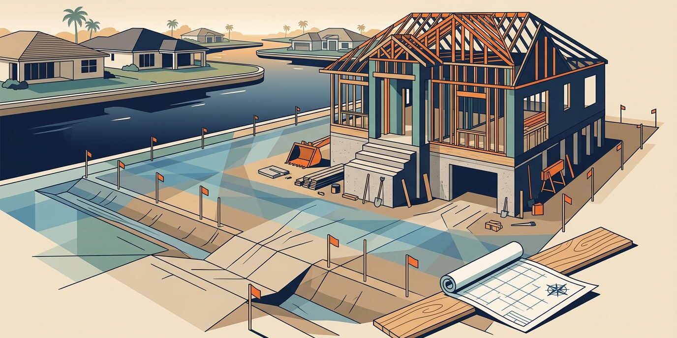
Building a new home in Cape Coral starts with more than a floor plan. Cape Coral flood zones can affect the foundation, finished-floor height, permits, insurance, construction budget, and long-term value of the property.
Both low- and high-risk designations require a parcel-specific review. We start with the lot, confirm its elevation and site data, and plan the home around actual conditions. This approach addresses concerns early instead of trying to solve them later.
Key Takeaways
- Cape Coral flood zones can affect a new home’s elevation, foundation, utilities, permits, insurance, construction budget, and long-term value.
- Review the exact parcel, FEMA map panel, effective date, BFE, DFE, drainage, and Elevation Certificate before finalizing plans or selecting a home model.
- Zones A, AE, and VE generally require more extensive floodplain review than Zone X, while Coastal A Zone and wave exposure can add structural and foundation requirements.
- Build the budget around site-specific costs, including surveys, engineering, grading, raised utilities, wind protection, flood-resistant construction, insurance, and inspections.
- Keep permits, elevation records, inspection reports, damage determinations, and written local decisions organized for construction, remodeling, insurance, and future resale.
Why Flood Zones Matter Before Construction
Flood risk information affects the home before the first form is set. It helps show whether the parcel lies in a Special Flood Hazard Area. Location, ground elevation, Base Flood Elevation (BFE), drainage, and access shape the design.
Lee County’s updated Flood Insurance Rate Map products became effective on November 17, 2022. These current panels use updated coastal studies and establish applicable base flood elevations for construction. The City of Cape Coral flood protection guidance explains how applicable map data connects to local building construction standards.
The Flood Map Changes the Starting Point
The applicable map panel can show an annual chance flood probability and may contain coastal notes. For a canal- or coast-adjacent lot, those notes may identify Coastal A Zone, the Limit of Moderate Wave Action, or storm surge zones.
The map can change the home’s height, foundation system, utility placement, site grading, and permitting documents.
We also review the exact map panel and effective date. A neighbor’s map result doesn’t automatically answer questions about your lot. Two properties on the same street can have different elevations, drainage patterns, or construction requirements.
The Lot and the House Must Work Together
A good plan fits the site. It doesn’t force the site to fit a standard plan.
The driveway, finished floor, garage, air-conditioning equipment, electrical service, grading, and stormwater flow should be reviewed together. A home that looks affordable on paper may need additional engineering or site work when placed on a lower lot.
That review belongs near the start of the budget conversation. It protects your schedule and gives you a clearer cost before construction begins.
How Flood Zones Change the Building Plan
The map identifies the property’s zone. Elevation information shows how the home should sit on the property.
Elevation, BFE, and DFE
The Base Flood Elevation is the estimated height of the base flood for a mapped area. It reflects an annual chance flood, a statistical event estimate, not a prediction of flooding every year.
New structures in regulated flood areas must meet the applicable Florida elevation requirements.
Cape Coral’s public flood information also identifies a Design Flood Elevation (DFE). The DFE can guide the required design height after local requirements and safety margins are considered.
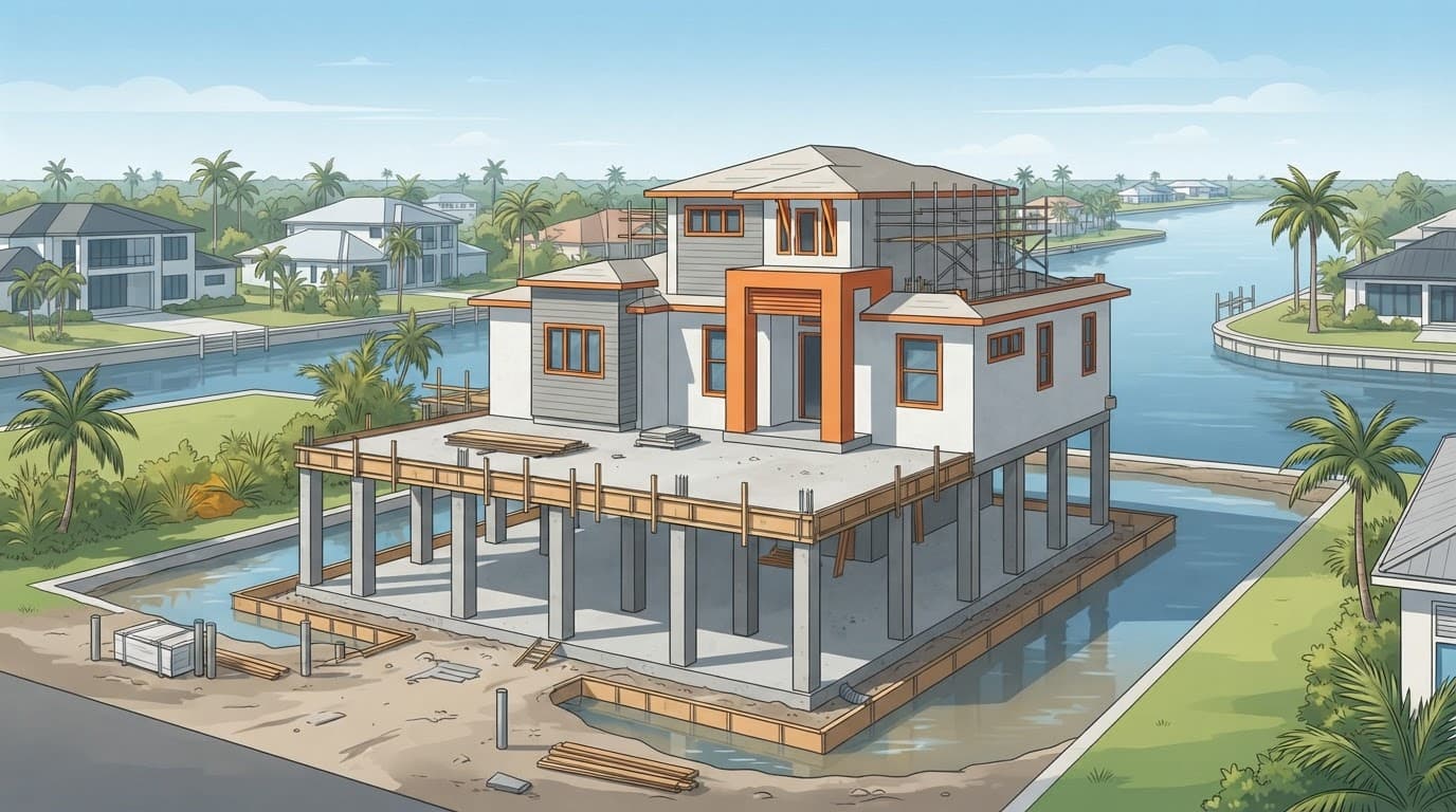
For many homes in a Special Flood Hazard Area, Cape Coral guidance calls for the lowest living floor to be at least one foot above the BFE. The exact requirement depends on the parcel, structure, flood zone, and current code provisions.
A surveyor, designer, engineer, or building official should confirm the final elevation before plans are approved. We don’t rely on an estimate from a listing or neighboring home.
Foundation, Fill, and Wind Design
The flood zone may affect whether a home uses a slab, stem wall, piers, pilings, or another engineered foundation. Soil conditions, grade, access, drainage, and the required finished-floor elevation all matter.
In a Coastal A Zone or near the Limit of Moderate Wave Action, wave exposure can affect foundation connections, enclosures, breakaway elements, and structural design.
Imported fill isn’t an automatic solution. Cape Coral guidance can limit fill beneath certain single-family foundations to 12 inches. Additional elevation may need to come from the foundation design instead.
Flood planning also works alongside wind protection. Cape Coral construction documents may need to address a basic wind speed of 160 mph, or a calculated speed where applicable, along with exposure category, roof design, windows, exterior openings, and components and cladding pressures.
The result is a home planned for both water and wind, with the foundation and structure working as one system.
Check the Lot Before Finalizing Plans
A flood review should happen before you select a final model or approve construction drawings. It can affect the home’s placement, garage layout, utility locations, and total project cost.
Use Official Flood Lookup Tools
Cape Coral directs property owners to the Forerunner Flood Information Portal and the city’s GIS system. The portal can display parcel-level flood-zone data, BFE, DFE, and other flood risk information. It can also help explain the statistical risk of an annual chance flood.
The city GIS lookup uses the “Flood Zones (Firm)” layer. Online tools provide an initial review, but they don’t replace a survey, official determination, or building-department confirmation.
You can also check the address through FEMA’s Flood Map Service Center, the official online source for FEMA flood mapping products. Search the property, review the relevant FEMA flood map and Flood Insurance Rate Map panel, then save the panel, effective date, and notes for your project file.
For waterfront or canal-adjacent parcels, review map notes for a Coastal A Zone and the Limit of Moderate Wave Action.
For properties outside Cape Coral in unincorporated Lee County, county flood tools may provide flood-zone verification and FIRM letters. A county letter isn’t a substitute for checking city requirements when the property is inside the Cape Coral municipal boundary.
Review the Elevation Certificate
An Elevation Certificate records ground elevations and shows how the building relates to the Base Flood Elevation (BFE) and mapped flood zone. It can support insurance quotes, map reviews, construction decisions, and future resale conversations.
A certificate for an existing structure may not answer every question about a new home. The proposed finished-floor elevation still needs to appear correctly on the construction plans.
Look for:
- The property and building location
- Flood zone and map panel information
- Ground elevations around the structure
- Lowest floor elevation
- Garage and enclosure information
- Machinery and equipment elevations
- Surveyor or engineer certification

Zone X Versus A, AE, and VE
Not every flood designation carries the same building or insurance requirements. Reviewing flood risk information and the complete flood zone designation helps buyers, homeowners, and investors compare lots more accurately.
Zone X is generally considered a low-risk flood zone outside the Special Flood Hazard Area. Its mapped probability is generally lower, but Zone X parcels don’t share identical hazards or the same annual chance flood exposure.
Zones A, AE, and VE are high-risk areas within the Special Flood Hazard Area. A zones may lack detailed elevation information, AE zones typically include it, and VE zones reflect coastal wave exposure.
Insurance and Mortgage Requirements
For a federally backed mortgage, flood insurance is generally mandatory when the building is in a Special Flood Hazard Area. That commonly includes Zones A, AE, and VE, and the 1% annual chance flood benchmark often guides the review. The lender makes the final determination for the loan, so confirm the requirement before closing.
Zone X properties may not trigger the federal mandatory-purchase rule. A lender, association, or private loan agreement can still require insurance.
Some qualifying properties may be eligible for a preferred risk policy, but eligibility isn’t automatic. Confirm whether the lender accepts a preferred risk policy before closing.
Compare a preferred risk policy with broader private coverage before choosing protection. An eligible flood insurance policy may still have limits, deductibles, exclusions, and lender-specific requirements.
Optional coverage may still make sense because heavy rain and drainage backups can create losses. Storm surge zones and surface water can also create losses outside the mapped designation.
Cape Coral and Lee County currently report Community Rating System Class 5 status, which is associated with a 25% discount for eligible National Flood Insurance Program policies. The discount may reduce flood insurance premiums, but it doesn’t remove the need to compare coverage limits, deductibles, exclusions, and private options.
A Zone X label can reduce insurance pressure, but it doesn’t remove site-specific water risk.
Coastal A Zones and Wave Exposure
Some coastal areas have a Coastal A Zone or a Limit of Moderate Wave Action designation. These areas may face stronger wave forces than a standard inland floodplain, even when the primary zone label looks familiar.
Map notes for a Coastal A Zone may explain whether a Limit of Moderate Wave Action designation changes the site’s review. Wave exposure can increase structural demands even when the mapped annual chance flood probability appears similar.
For a Coastal A Zone, review foundation connections for conditions associated with a Limit of Moderate Wave Action. A Coastal A Zone review should address enclosures and breakaway elements where a Limit of Moderate Wave Action applies.
In a Coastal A Zone, the lowest-floor measurement may follow guidance tied to a Limit of Moderate Wave Action. Insurance and resale reviews should note a Coastal A Zone and any Limit of Moderate Wave Action designation.
Ask whether the lot’s Coastal A Zone status changes construction, coverage, or buyer due diligence. The right question isn’t only, “What zone is this lot?” It’s also, “What water and wave conditions must this structure withstand?”
Permits, Remodeling, and Substantial Damage Rules
New construction requires a building permit, but floodplain review can add documents and inspections. Plans may need elevation details for the applicable annual chance flood, foundation engineering, site drainage information, wind design, and utility placement.
When Improvements Trigger Current Standards
Substantial improvement rules can affect an older home that is being remodeled. If improvement costs reach the applicable threshold, substantial improvement may require the project to meet current floodplain standards. In that case, substantial improvement requirements can govern regulated work instead of ordinary maintenance.
Substantial damage rules can apply after a storm. If repair costs reach the applicable threshold, substantial damage may mean repairs aren’t treated as ordinary maintenance. Substantial damage requirements can then trigger current floodplain standards and additional review. In many NFIP programs, the threshold is 50% of the building’s market value, but local valuation and enforcement rules control.
Insurance, increased cost of compliance coverage, and federal disaster assistance follow separate eligibility rules. None guarantees payment for every repair or removes permit requirements.
This matters after hurricanes such as Ian and Milton. A buyer may see a home that looks repairable, while the permit history shows that substantial improvement or substantial damage rules could create a larger compliance requirement.
Eligibility for federal disaster assistance is separate from floodplain compliance, so funding approval doesn’t resolve permitting questions.
Before buying or remodeling, request permit records, damage determinations, prior elevation documents, and written determinations about substantial improvement and substantial damage. Also request federal disaster assistance records and written confirmation from the local building department; a verbal answer isn’t enough for a major investment.
Map Amendments Need Evidence
A Letter of Map Amendment (LOMA) can help when natural ground or a structure is shown incorrectly in a Special Flood Hazard Area. Coastal notes, including a Coastal A Zone or Limit of Moderate Wave Action designation, may still affect local construction review.
A Letter of Map Revision Based on Fill (LOMR-F) may apply when fill has raised a site and supporting evidence meets FEMA requirements.
These requests usually need accurate surveys, elevation data, site information, and technical documentation. A Letter of Map Revision request is evidence-based, and approval isn’t automatic.
A successful map change also doesn’t erase every local construction requirement. It may change the FEMA designation or insurance determination, while local drainage, zoning, wind, building construction standards, and permitting rules still apply.
Build the Budget Around the Site
Flood-zone construction costs don’t come from one line item. The financial effect can appear in the survey, engineering, foundation, grading, utility placement, permits, flood insurance premiums, and future maintenance. Projected insurance and site costs should reflect the parcel’s mapped risk and annual chance flood exposure, not a nearby home’s average.
Costs Beyond the Floor Plan
A realistic early budget should account for:
- Survey and elevation information
- Foundation and structural engineering
- Soil, drainage, and site preparation
- Raised utilities or equipment
- Required flood-resistant construction details
- Wind-rated windows, doors, and roof connections
- Permit, review, and inspection fees
- Flood insurance and lender requirements
Don’t treat federal disaster assistance as a substitute for insurance in the construction budget. For a qualifying lower-risk property, a preferred risk policy may provide a useful insurance comparison. Compare its limits, deductibles, exclusions, lender requirements, and renewal pricing.
We also review how the plan uses the lot. A larger garage, enclosed storage area, or lower mechanical room may create a problem if it sits below the permitted elevation.
Duplex investors should review both units, not one side only. Each unit may have separate living areas, entrances, utility connections, and finish-floor conditions. Combined square footage on a listing doesn’t replace a full construction and flood review.
Resale, Rentals, and Long-Term Ownership
A property’s flood history and available preferred risk policy options can influence future buyers, lenders, insurers, and tenants. Keeping the approved plans, elevation records, permits, inspection records, and final closeout documents together makes future questions easier to answer. Future buyers and lenders may ask about substantial improvement, substantial damage, federal disaster assistance, repairs, and permit history.
A lower-risk property may attract buyers who want more predictable ownership costs. A higher-risk property can still perform well when it has proper elevation, documented compliance, reliable drainage, and realistic insurance costs. Flood mitigation assistance may be available, but verify program eligibility and funding.
The best construction budget is based on the actual parcel, not the average cost of a nearby house.
Keep Construction Checks in Writing
Flood compliance matters, but water protection also depends on installation quality. We review the work at each stage because hidden defects become more expensive once concrete, insulation, or drywall covers them.
Inspect Before Work Gets Covered
At the pre-pour stage, review forms, dimensions, setbacks, reinforcement, slab edges, grade beams, anchor locations, and foundation elevations. This is the last practical opportunity to correct many components before concrete conceals them.
Before drywall, check utility placement, plumbing connections, ductwork, insulation, attic openings, exterior penetrations, and equipment locations. Confirm that items required to remain above a required elevation are correctly placed before finishes close the walls.
A home inspection can also identify missing roof flashing, poor grading, unsealed penetrations, damaged stucco, disconnected ducts, loose plumbing, and unprotected electrical work. These issues may look minor at first, but water often enters through small omissions.
Close Out the Punch List
A clear punch list separates structural defects, safety hazards, water risks, system problems, code questions, and cosmetic corrections. For each item, record the room, location, photograph, requested correction, responsible trade, and target completion date.
Send the report to the builder and request a written response. If there is disagreement, ask for the plan, specification, or code section supporting that position. This keeps the project clear and prevents a verbal promise from disappearing.
If access to a pre-drywall inspection is denied, ask for the policy in writing and raise the issue with your real estate agent and closing attorney. Your contract controls many inspection and closing rights.
Don’t sign a document stating that known defects are corrected while they remain open. A reinspection can confirm that repairs were completed before final sign-off.
Frequently Asked Questions
How do I find the flood zone for a Cape Coral property?
Use the City of Cape Coral GIS system, the Forerunner Flood Information Portal, and FEMA’s Flood Map Service Center to review the parcel and applicable map panel. Online tools provide an initial review, but a survey, official determination, and building-department confirmation may still be necessary.
What is the difference between BFE and DFE?
The Base Flood Elevation, or BFE, is the estimated height of the base flood for a mapped area. The Design Flood Elevation, or DFE, can guide the required design height after local requirements and safety margins are considered.
Does Zone X mean flood insurance is unnecessary?
Zone X is generally outside the Special Flood Hazard Area and may not trigger the federal mandatory-purchase rule for a federally backed mortgage. A lender, association, or private loan can still require coverage, and optional insurance may be useful because heavy rain, drainage backups, and surface water can cause losses.
How can a flood zone affect new home construction?
It may change the home’s finished-floor elevation, foundation type, utility placement, grading, wind design, permits, and required engineering. The applicable requirements depend on the parcel, flood zone, elevation data, coastal notes, and current local code provisions.
Can a flood zone affect remodeling or storm repairs?
Yes. Substantial improvement or substantial damage rules may require work to meet current floodplain standards when the applicable cost threshold is reached. Before buying or remodeling, request permit records, damage determinations, prior elevation documents, and written decisions from the local building department.
Conclusion
Cape Coral flood zones affect new construction well before the first day on site. The designation can change elevation, foundation design, wind details, permits, insurance, and total ownership costs.
We get better results when we verify the parcel’s flood risk information, BFE, DFE, map panel, Elevation Certificate, and local requirements before finalizing the plan.
Insurance decisions and federal disaster assistance are separate considerations. Neither replaces parcel verification, compliant design, or written local confirmation.
If you’re ready to review a new home project, request a new home construction consultation so the site conditions can be part of the plan from the beginning.