
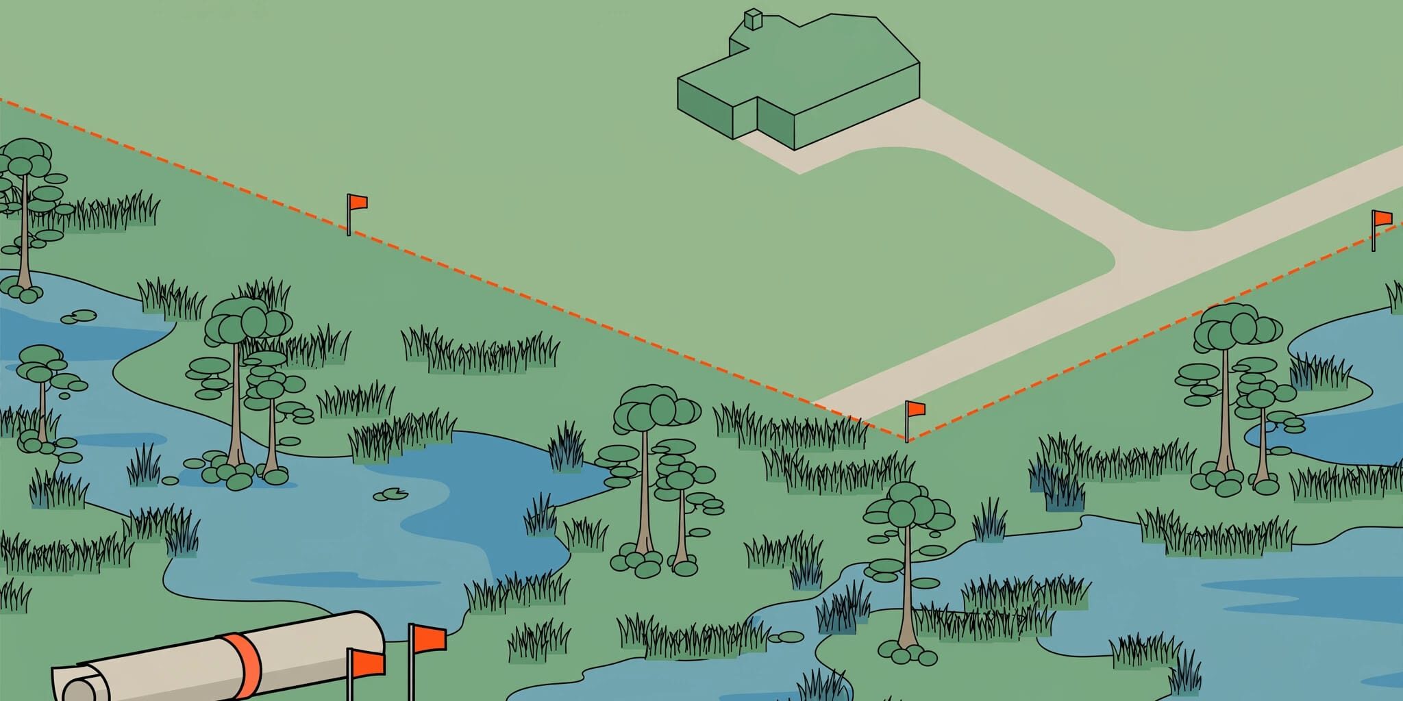
Wetland delineation identifies wetland boundaries so you can assess a lot’s usable space before you buy. A low purchase price means little if your home, driveway, and drainage plan won’t fit.
Review wetlands during your contract’s due diligence period, while you still have options. Start with the buildable area, then connect the environmental findings to your construction budget.
Key Takeaways Before Making an Offer
- Maps can screen a parcel for wetlands, but an on-site delineation establishes the boundary.
- An informal consultant report supports purchase decisions. A formal agency determination provides a binding state boundary decision.
- Wetland buffers, access, drainage, and septic requirements can reduce usable upland space.
- Budget separately for fieldwork, surveying, agency review, permitting, and any required mitigation.
Finding wetlands on a lot doesn’t automatically prevent construction. It changes the questions that need answers before closing.
What a Florida Wetland Delineation Establishes
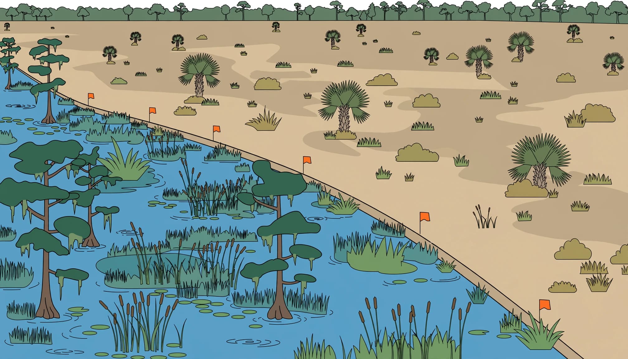
A delineation maps the wetland boundary between wetlands and uplands. It doesn’t establish property ownership, authorize work, or guarantee the lot is buildable.
The Three Wetland Indicators
Professionals evaluate hydrophytic vegetation, meaning plants adapted to wet conditions; hydric soils, which develop under prolonged saturation; and wetland hydrology, including evidence of recurring flooding or saturation. These indicators help distinguish wetlands from uplands.
Under normal conditions, the federal method generally requires all three parameters. A missing required parameter generally means the federal wetland criteria aren’t met. However, disturbed sites, drought conditions, and problematic soils require additional analysis.
A dry surface or missing wetland plants alone isn’t reliable proof of uplands.
The State and Federal References
Florida delineations follow Chapter 62-340, F.A.C., the statewide methodology used by FDEP and the state’s five Water Management Districts. The Florida Wetlands Delineation Manual explains the state’s approach.
Federal work uses the 1987 Corps of Engineers Wetland Delineation Manual and the Atlantic and Gulf Coastal Plain supplement. Its interim edition appeared in October 2008; Version 2.0 followed in 2010.
The Atlantic and Gulf Coastal Plain guidance addresses local vegetation, soils, hydrology, and difficult wetland situations. State and federal findings can differ.
How the Delineation Process Works
We recommend completing the environmental review before finalizing a home layout. A wetland delineation usually follows these steps:
- A desktop review of National Wetlands Inventory maps, NRCS soil surveys, aerial photographs, FEMA information, and property records screens the parcel for wetlands.
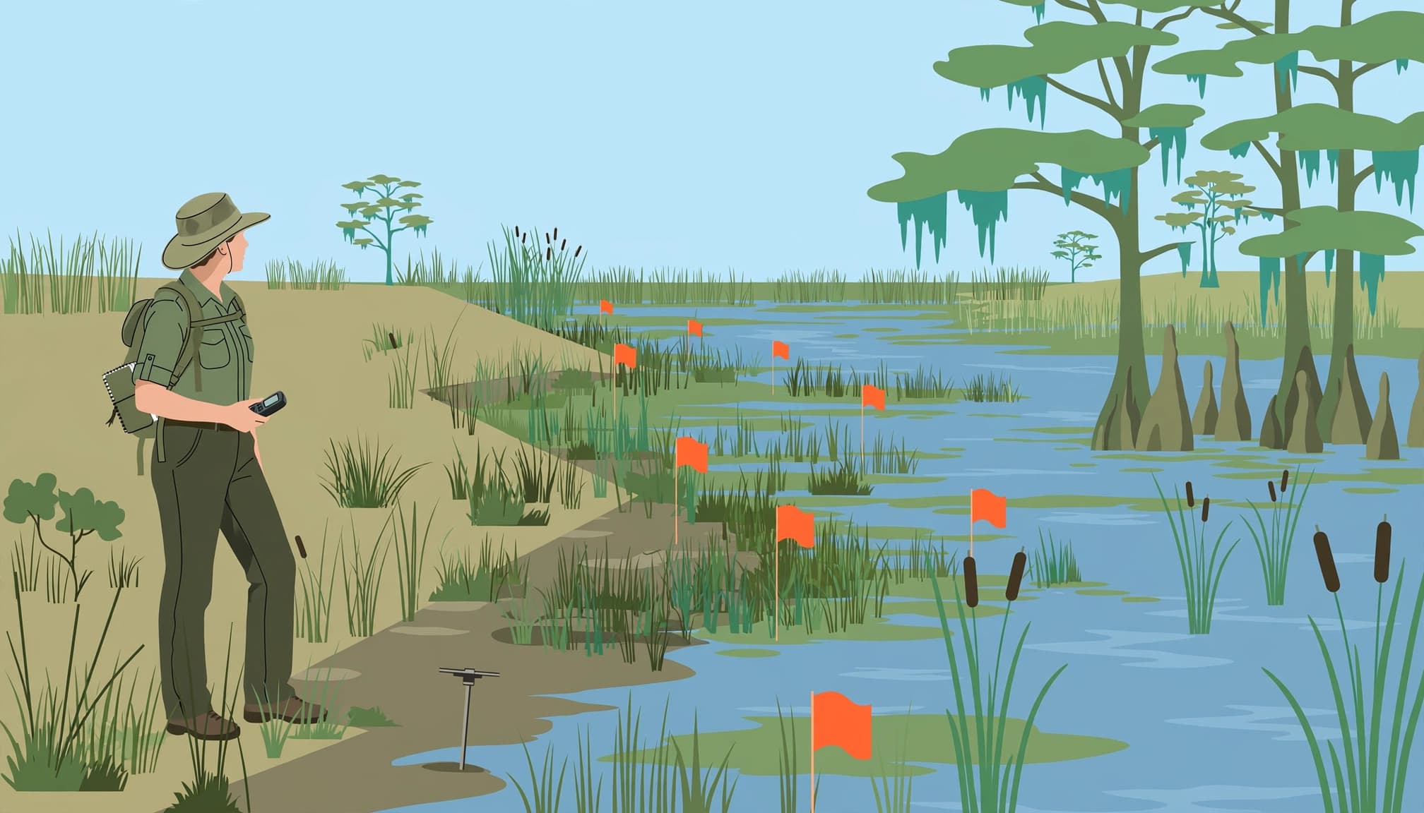
- During the field investigation, the consultant evaluates hydrophytic vegetation, hydric soils, and hydrologic indicators across the suspected boundary.
- Flagging marks the wetland edge so other project professionals can locate it.
- GPS mapping documents the findings. For permit applications, a licensed land surveyor typically surveys the flags and plots them on the site map.
- Agency coordination addresses boundary review, jurisdiction, and the documentation needed for the proposed work.
The final deliverable should identify the parcel, methods, findings, boundary, and limitations. Photos and field data help explain the conclusion.
A property boundary survey and a delineation serve different purposes. You may need both, along with topographic information, to develop a workable site plan.
A house footprint clear of wetlands doesn’t solve a driveway crossing, drainage conflict, or septic placement problem elsewhere on the lot.
Informal Delineation or Formal Wetland Determination?
The right starting point depends on how much certainty your purchase and construction plans require.
For Purchase Decisions
An informal delineation is a consultant’s nonbinding field assessment. It helps buyers and realtors understand likely wetland limits before committing more money.
This is often a practical first step when comparing lots or deciding whether to continue due diligence. Ask for a mapped wetland delineation and written findings, not just a verbal opinion.
The report doesn’t bind an agency or authorize clearing and filling.
For Agency Certainty
A formal state determination establishes an agency-reviewed, legally binding boundary under Florida’s methodology. Agency review can also verify a mapped wetland boundary.
A separate state determination isn’t automatically required for every homebuilding project. It can be valuable when the boundary is disputed, construction approaches wetlands, or the purchase depends on an accepted boundary.
State formal determinations generally remain valid for five years. USACE Approved Jurisdictional Determinations also generally last five years, but address federal jurisdiction.
Neither document authorizes construction or replaces a permit. An expired determination may require updated fieldwork and agency review.
Costs and Timelines to Budget Before Closing
Florida wetlands delineation pricing varies because proposals often cover different services. Acreage matters, but vegetation density, access, mapping requirements, and agency involvement also affect the price.
Compare the Scope Behind the Price
Published consultant fee examples include these acreage-based charges:
| Parcel Size | Example Fee |
|---|---|
| 0 to 0.99 acres | $350 |
| 1 to 2.99 acres | $400 |
| 3 to 4.99 acres | $525 |
| 9 to 9.99 acres | $925 |
| 10 acres or more | Individually quoted |
These figures aren’t statewide rates or complete project budgets. Other published estimates place small plots around $1,500 to $3,000 and larger properties around $3,000 to $10,000 or more.
Compare written proposals against the same scope. Check whether each price includes field data, flagging, a report, survey coordination, agency meetings, permitting, and help preparing a permit application. Surveying, agency fees, engineering, and mitigation may be separate.
Allow Time for Review
A reasonable planning allowance is roughly 2 to 4 weeks for fieldwork and associated deliverables. Agency concurrence commonly takes another 30 to 90 days.
These are planning ranges, not guaranteed deadlines. Access problems, incomplete submissions, agency workload, or disputed boundaries can extend the schedule.
A short inspection period may expire before the environmental review is complete. Build enough time into the purchase contract to receive and assess the findings as part of your due diligence.
Who Reviews Delineations and Proposed Impacts?
Florida’s environmental permitting includes review under the Environmental Resource Permit program by FDEP or the appropriate Water Management Districts. Agency agreements assign review responsibilities, and delegated local programs may also have a role.
The five districts are South Florida, Southwest Florida, St. Johns River, Suwannee River, and Northwest Florida. County and municipal requirements also apply.
State, Federal, and Local Approval
FDEP’s wetland determination and impact guidance distinguishes identifying jurisdictional wetlands from getting authorization for regulated work.
State review under the Environmental Resource Permit program covers surface waters, stormwater, and jurisdictional wetlands. Federal Section 404 authorization through USACE covers regulated discharges of dredged or fill material into federally jurisdictional waters. State and federal jurisdiction can differ.
A finding that an area falls outside federal jurisdiction doesn’t remove state or local requirements.
Filling, Crossings, and Mitigation
Some residential impacts of one-half acre or less may qualify for a Nationwide Permit, subject to applicable conditions. Eligibility for a Nationwide Permit depends on regional requirements and project details, not acreage alone. Larger or more complex impacts may need individual federal review, which can take months to years.
Avoidance and minimization come first. Where compensation is required, options include bank credits, approved in-lieu fee programs, or permittee-responsible mitigation. The EPA explains how Section 404 mitigation banks can offset authorized impacts.
Buying credits doesn’t authorize impacts. A delineation identifies boundaries but doesn’t approve work. Don’t place fill, mulch vegetation, or cut an access road through a suspected area before environmental review.
Connect the Wetland Map to the Home Plan
We look at a lot as a complete construction site. The house, garage, driveway, utilities, drainage features, and septic system all need workable locations.
Overlay the mapped wetlands boundary and any applicable buffers on a current survey. Compare the usable area with zoning setbacks, easements, existing grades, and the proposed footprint.
Flood zones and wetland status require separate reviews. A FEMA flood-zone designation doesn’t establish wetland status, and a dry-day visit doesn’t reveal seasonal groundwater conditions.
Legal access matters too. A visible trail doesn’t prove a recorded right to reach the property. An easement that crosses an environmentally restricted area also doesn’t authorize a crossing for the proposed work.
For lots in Lee, Charlotte, or Highlands County, keep the review parcel-specific. County and municipal submission requirements can differ. Once the property records and environmental findings are available, you can discuss your homebuilding plans with our team and connect the usable area to the construction scope.
Frequently Asked Questions
Does Every Lot Need a Wetland Determination?
No. Florida doesn’t require a separate determination for every residential lot. Suspected wetlands, nearby surface waters, prior records, and permit requirements determine whether one is needed.
An empty wetland map layer isn’t enough to establish that a questionable parcel is upland. On-site findings provide stronger purchase information.
Who Can Perform a Wetland Delineation?
A qualified environmental consultant familiar with Chapter 62-340 and applicable federal methods can assess wetlands in the field. The reviewing agency decides whether it accepts the findings.
A Florida-licensed Professional Surveyor and Mapper handles the property survey and surveyed wetland locations. Surveying alone doesn’t establish wetland jurisdiction.
What Is the 50/20 Rule?
In the federal dominance procedure, plants are ranked by cover within each vegetation layer. Dominants include species whose combined cover exceeds 50%, plus any species that individually contributes at least 20%.
That identifies dominant species for vegetation analysis. It isn’t a complete wetland test or a substitute for Florida’s state methodology.
Buy With a Workable Building Area
A sound lot purchase starts with wetlands findings that define the usable building area and account for access, drainage, setbacks, and a realistic site-work budget.
We recommend resolving those questions while your contract still provides time and options. Clear findings before closing support a dependable construction plan.