
A vacant lot can look ready for a home and still carry expensive limits below the surface. A current boundary survey shows the parcel’s boundaries, visible conditions, and issues that need attention before money changes hands.
The survey isn’t a permit, wetland determination, title opinion, or guarantee that a home plan will fit. It’s one part of a stronger due-diligence file that also includes title records, zoning details, flood zone information, and building permits.
Review these items while your contract still gives you time to request answers, changes, or written solutions.
Start With the Right Type of Survey
A seller’s old survey may help you ask questions, but it may not show the lot’s current conditions. For a vacant parcel, we recommend ordering a current boundary survey before closing, especially if you plan to build soon.
Use a Florida-Licensed PSM
A Florida-licensed Professional Surveyor and Mapper, often called a PSM, should perform, sign, and certify boundary work under applicable standards of practice. Under Florida Statutes, Chapter 472, surveying includes facts about a property’s size, shape, topography, legal location, and orientation.
A real estate agent, contractor, lender, or title company can help you review documents. They cannot certify the location of property lines. That work belongs with the licensed surveyor.
Know What You Ordered
A general land survey may involve a broader scope than a boundary-only assignment. The ordered work should identify and retrace the legal parcel boundary using the deed, recorded plat, and other controlling records. It should show corners, survey monuments, dimensions, visible fences, improvements, and evidence found in the field.
A topographic survey adds elevations, contours, and site features that can affect drainage, driveway grades, and finished-floor planning. An ALTA/NSPS Land Title Survey is different again. It’s more common for a commercial survey when lender and title insurance requirements call for a deeper review.
A boundary survey confirms where the parcel is. It does not confirm that every square foot inside the boundary is buildable.

Review Your Florida Building Lot Survey Against the Deed
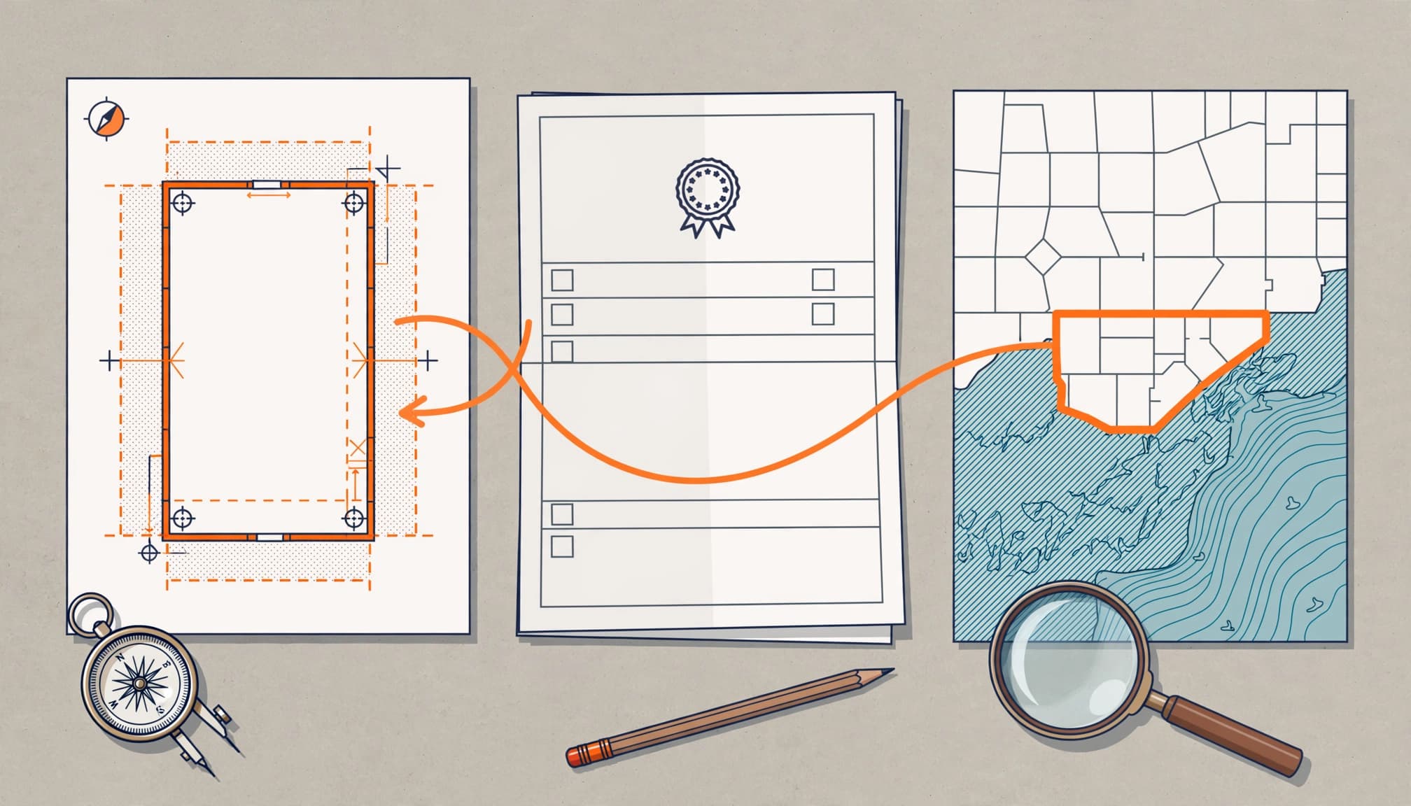
Start with the survey’s title block, date, surveyor seal, north arrow, scale, and legal description. Then compare it with your deed, title commitment, and recorded plat.
Confirm the legal description matches across the survey, deed, contract, and title commitment. Check lot and block numbers for a platted subdivision. For metes-and-bounds descriptions, review bearings, distances, and calls to monuments.
A small difference in a parcel map may be harmless. A conflict between the deed description and the survey deserves a direct answer before closing. If deed research reveals conflicting survey monuments or boundary evidence, ask a Professional Surveyor and Mapper to review the issue under applicable standards of practice.
Title or legal conflicts require guidance from the title company, a Florida-licensed surveyor, or a real estate attorney, not an agent’s interpretation. County GIS maps and property appraiser maps are useful reference tools. They are not a replacement for a signed boundary survey.
Read Every Note and Exception
Look beyond the bold property lines. Notes may identify easements, encroachments, shared fences, walls, utilities, drainage features, access corridors, or potential encroachment issues.
A fence inside the lot line may mean a neighbor has been maintaining land they do not own. A fence beyond the line may place part of your future yard on someone else’s property. Either situation can affect a pool, lanai, driveway, shed, or fence installation.
If the title commitment lists an easement, make sure the survey shows its location when possible. A utility easement across the rear of a lot can limit where you place a pool, patio, drainage feature, or addition.
Find the Real Buildable Area
A boundary survey helps establish lot dimensions, but lot size is only the starting point. The space left after setbacks, easements, drainage needs, environmental limits, and access requirements is what matters to your home plan.
Measure Setbacks From the Closest Point
Setbacks are required open areas between improvements and boundaries. Local rules may measure to the closest part of the home, including a garage corner, roof overhang, porch, screened enclosure, or wall.
A wide lot can still be difficult if it is shallow, pie-shaped, irregular, or crossed by an easement. Ask the county or city zoning office, not the surveyor alone, to confirm the current setback requirements, property lines, and permit conditions for the exact parcel and zoning district.
Put a rough home footprint on the survey before closing. Include the garage, driveway, air-conditioning equipment, pool area, lanai, and space needed for drainage.
Check What the Survey Does Not Decide
The survey may show physical features, but it doesn’t settle every development question. Wetlands, septic or well conditions, protected trees, soil, flood zone requirements, and utility availability can require separate review.
Zoning, site conditions, and building permits involve reviews beyond the survey. For lower or uneven lots, a topographic survey may be needed. Existing grade, drainage paths, culverts, swales, and elevations can change the foundation, fill, and site-work budget. A low-priced lot isn’t a good value if the home needs major grading or engineering later.
Confirm Legal Access, Not Just a Visible Driveway
A dirt road, driveway, trail, or neighbor’s open gate doesn’t prove legal access. A parcel can appear easy to reach and still lack a recorded right to use the route.
Follow the Route to a Public Road
Compare the survey, recorded plat, deed, aerial image, and title commitment. Confirm that the lot touches a public right-of-way or benefits from a recorded easement that reaches one.
If access depends on an easement, read the recorded document. Confirm its location, width, permitted use, maintenance duties, and the parcels it benefits. A verbal agreement with a neighbor doesn’t give the buyer a reliable property right.
Consider Construction Access Early
A narrow route may work for a car but not for concrete trucks, utility crews, emergency vehicles, or a future moving truck. Drainage across a private road can also change its usability during Southwest Florida’s heavy rain.
Ask local officials which approvals may apply, such as a driveway connection, culvert, road improvement, or related building permits. The survey can show physical conditions. It can’t create access rights or approve a driveway location.
Look Closely at Survey Monuments and Boundary Evidence
Survey monuments are the physical markers that help establish corners and lines. They may be iron rods, concrete markers, capped pipes, nails, or other evidence identified by the surveyor.
Missing Corners Need a Clear Explanation
Older lots, wooded parcels, and land that has been cleared or regraded may have disturbed markers. A missing corner does not automatically indicate a defect, but it should not be ignored.
A boundary survey or land survey may require deed research, recorded plats, nearby evidence, and field work by a Professional Surveyor and Mapper. That work can add time and cost, especially when surrounding records conflict.
Uncertain property lines or potential property disputes should be addressed under applicable Florida Statutes and professional standards of practice. Review the state land surveying requirements when you need a clearer understanding of the licensed professional’s role.
Ask What Was Found in the Field
Ask the surveyor which corners were found, which were set, and which were calculated or held from prior evidence. Also ask whether nearby fences, walls, driveways, or improvements appear to cross the boundary.
If a boundary issue affects the home location or your ability to use the lot, resolve it in writing before closing. Don’t rely on a verbal promise that the matter will be handled later.
Check Flood, Drainage, and Environmental Conditions
A dry-day walk-through can hide a drainage problem. Southwest Florida rain tests every swale, culvert, driveway transition, and low point on the property.
Review Elevation With the Home Plan
Check the current flood zone, base flood elevation when applicable, existing grades, and any available Elevation Certificate. A FEMA map result for a nearby home isn’t enough. Two lots on the same street can have different grades, drainage paths, and building requirements.
That flood zone designation can affect finished-floor elevation, foundation design, insurance, fill, utility placement, and driveway slope. A surveyor documents site conditions, while floodplain staff and local officials address floodplain review and building permits.
Treat Wetlands as a Separate Review
Wetland-adjacent vegetation or standing water can raise questions, but a boundary survey alone doesn’t establish wetland jurisdiction. Ask for any existing environmental reports, permits, mitigation records, and land-clearing documents. Engineers, floodplain staff, or other specialists may also be needed.
Historical information can support deed research and help explain older parcel lines and records. LABINS land records include Florida township plats, original surveyor field notes, and sales plats dating to around 1824.
Plan for Survey Cost and Timing
Survey costs are not set by one statewide fee. A standard residential boundary survey for a straightforward residential property may fall around $400 to $1,500, but that range isn’t binding and depends on the parcel and work required.
Know What Changes the Quote
A small, clear, platted lot with good records is usually more straightforward than a wooded, irregular, rural, waterfront, or disputed parcel. Cost and timing can rise when survey monuments are missing, deed research is extensive, access is difficult, records are unclear, or you need topographic work. A Professional Surveyor and Mapper can identify whether those issues expand the scope.
In Southwest Florida, local conditions may affect access or scheduling. Urgent requests may also cost more. Don’t assume every survey can be completed within the same week. Order early enough to review the finished drawing before your inspection or due-diligence deadline.
Send Useful Documents Up Front
Give the surveyor the current deed, parcel identification number, recorded plat if available, title commitment, prior survey, and your intended use of the lot. Mention planned features such as a pool, detached garage, fence, driveway, or commercial building.
Clear information helps the surveyor quote the right scope. It also helps you avoid ordering a basic boundary survey when a topographic survey or added field work is needed. Confirm that the quoted scope reflects applicable standards of practice.
Key Takeaways Before Closing
Keep your review focused on the decisions that affect ownership, building plans, and budget.
- Confirm that a Florida-licensed PSM prepared and sealed the current boundary survey.
- Match the legal description and dimensions with the deed, title commitment, and recorded plat.
- Identify setbacks, easements, fences, encroachments, drainage features, and visible access routes.
- Check whether the home footprint, driveway, utilities, and outdoor space fit inside the usable area.
- Verify flood, elevation, wetland, septic, well, and site-work questions through the right local professionals.
- Resolve title defects, boundary conflicts, and easement concerns in writing before closing.
Frequently Asked Questions
Is a Survey Required for a Florida Building Permit?
Requirements for building permits and survey-related submittals vary among Florida counties, municipalities, flood zones, and project types. Some jurisdictions request a signed and sealed survey, flood information, elevation details, or a site plan. A Professional Surveyor and Mapper is the appropriate professional to prepare or certify survey information when the local checklist calls for it. Confirm the current checklist with the local building department before you finalize plans.
Does Florida Law Require a Survey Before Building a Fence?
Florida does not have one statewide rule requiring every owner to obtain a survey before installing a fence. Local rules and HOA standards may still apply. A current survey is a smart investment when the fence will sit close to a boundary or easement.
What Should Happen if an Easement Crosses the Lot?
Read the recorded easement document and compare it with the survey. Confirm who can use it, where it lies, how wide it is, and whether your planned home or driveway conflicts with it. Do not close on an easement-dependent lot until the document is acceptable and tied to the correct parcels.
Move Forward With Clear Property Information
A strong lot purchase is built on more than a good price and a clear view. It depends on documented boundaries, workable buildable space, legal access, and realistic site conditions.
Once your boundary survey, title review, and local requirements, including building permits, support your plans, you can make decisions with more confidence. Survey results support planning, but title issues, legal access, permits, zoning, flood review, and site conditions may still require appropriate Florida-licensed professionals. For practical home placement, budget, and site-work questions, contact Nathan’s Homes about your building project in Southwest Florida.